


- MADISON: In an effort to create jobs, legislators passed a bill that changes the standards for approving a mine, which would allow for GTAC to more easily build a mine.
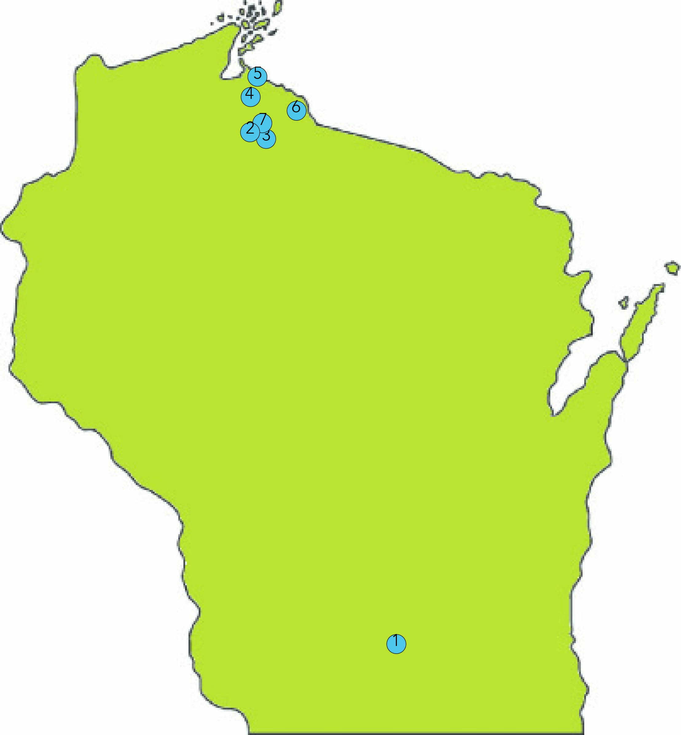
- PROPOSED MINING SITE: The proposed mine would stretch 22 miles across Ashland County and a small portion of Iron County. Lawmakers say a mine would bring hundreds of jobs to the area, but Native Americans and environmentalists are afraid it would destroy the Penokee Hills and Bad River water supply.
- PENOKEE HILLS: The hills are a mountainous area in northern Wisconsin and home to the headwaters of the Bad River. Because they are rich in iron ore, GTAC hopes to build a mine in the hills.
- BAD RIVER RESERVATION: This is the home of the Bad River Band of the Lake Superior Tribe of Chippewa. Its proximity to the sloughs makes the wild rice an important crop for the people of Bad River.
- SLOUGHS: The Kakagon and Bad River sloughs are wetlands where the Bad River meets Lake Superior. The Bad River Band is worried a mine would infect this water, killing the wild rice that grows in the sloughs.
- HURLEY: Hurley is an old mining town, providing the U.S. with iron during both world wars. Civilians here are more favorable to the idea of a new mine because of the town’s history and the promise of new jobs.
- LCO HARVEST CAMP: The proposed mine wouldn’t only affect the Bad River Band. The Lac Courte Oreilles Band of Lake Superior Tribe of Chippewa has gained national attention for the camp they set up to claim their treaty rights to the land.
Check out Heroes of the Hills: The Hopeful Legend of the Bad River Tribe for more information about the mining debate.